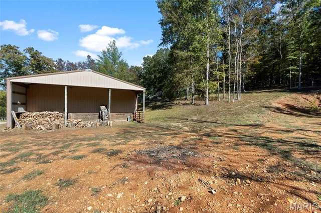
165 State Highway U
Land & Acreage
Land Features & Use
Water & Utilities
Structures & Outbuildings
Financial & Terms
About Cape Girardeau County
Where the Bootheel meets the hills — cropland and deer woods.
Cape Girardeau County marks the northern gateway to the Bootheel, where the flat lowlands meet the rising Ozark escarpment along the Mississippi River. This is the region's most varied ground: fertile bottomland along the river and the Whitewater and Castor drainages gives way to rolling, timbered hills to the west. That mix suits buyers who want both worlds — productive cropland of soybeans, corn, and wheat in the bottoms, and wooded uplands that hold whitetail and turkey. Rivers and creeks thread the county, adding waterfowl to the flooded lowlands and fishing to the mix. For a land buyer seeking farm income and genuine hill-country hunting within reach of the delta, Cape Girardeau offers the fullest blend in southeast Missouri.
Location
Get DirectionsContact Oakhaus
A specialist will respond within 1 business hour.
Similar Land & Farm


Listing information is deemed reliable but not guaranteed and should be independently verified. IDX information provided by MARIS MLS. Listing courtesy of Century 21 Ashland Realty. Listed by Sandy Tegel.
MLS# MIS26068027 · Key: MIS208734757 · Last updated: Oct 22, 2026
© 2026 MARIS MLS. All rights reserved. The data relating to real estate for sale on this website comes in part from the Broker Reciprocity Program of MARIS MLS. Real estate listings held by brokerage firms other than Keller Williams Local are marked with the Broker Reciprocity logo.